Satellite Cal/Val
The Remote Sensing Department is participating in calibration and validation (Cal/Val) efforts for atmospheric measurements satellites, such as EarthCARE and the upcoming Sentinel-4 and Sentinel-5. Throughout the years, the department has contributed to the optimization and validation of products obtained from, but not limited to, the AEOLUS, CALIPSO and Sentinel-5P satellites.
For this, the department employs a suite of standard reference ground-based instruments, such as lidars, UV-VIS or infrared spectrometers. These instruments measure at the same time as the satellite passes overhead the INOE measurement station, offering spatially and temporally collocated measurements. Afterwards, these correlative measurements are analyzed together with the satellite data, looking for inconsistencies and differences between the obtained products.
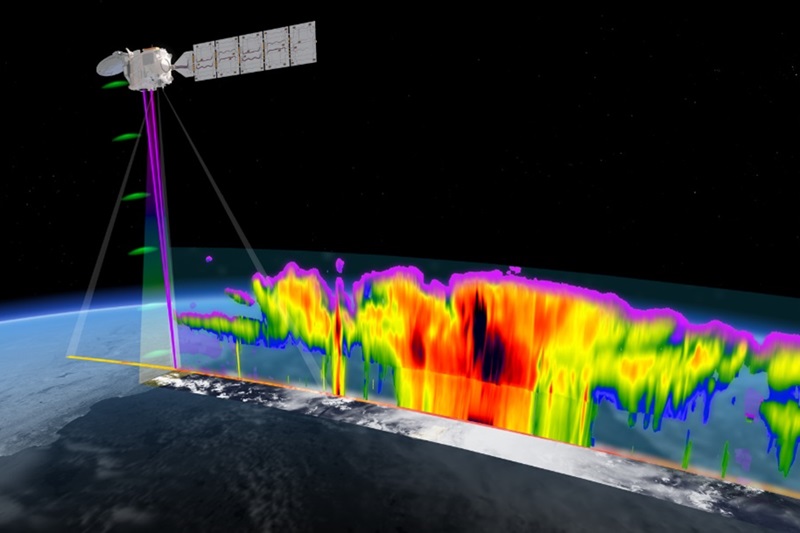
Title: EarthCARE for a better understanding of Earth’s radiation balance. Copyright: ESA
All of these analyses are then summarized in Cal/Val reports, which are sent to the respective satellite’s operating institution and discussed within the scientific community, providing insight and aiding in proper calibration and exploitation of the satellite. Furthermore, studies are continuously performed throughout the satellite’s lifespan in order to ensure good quality data is being provided and to correct for possible instrumental degradation of the satellite’s payload.